by :Dr.Bakhtyar Ahmed mala
7/5/2026
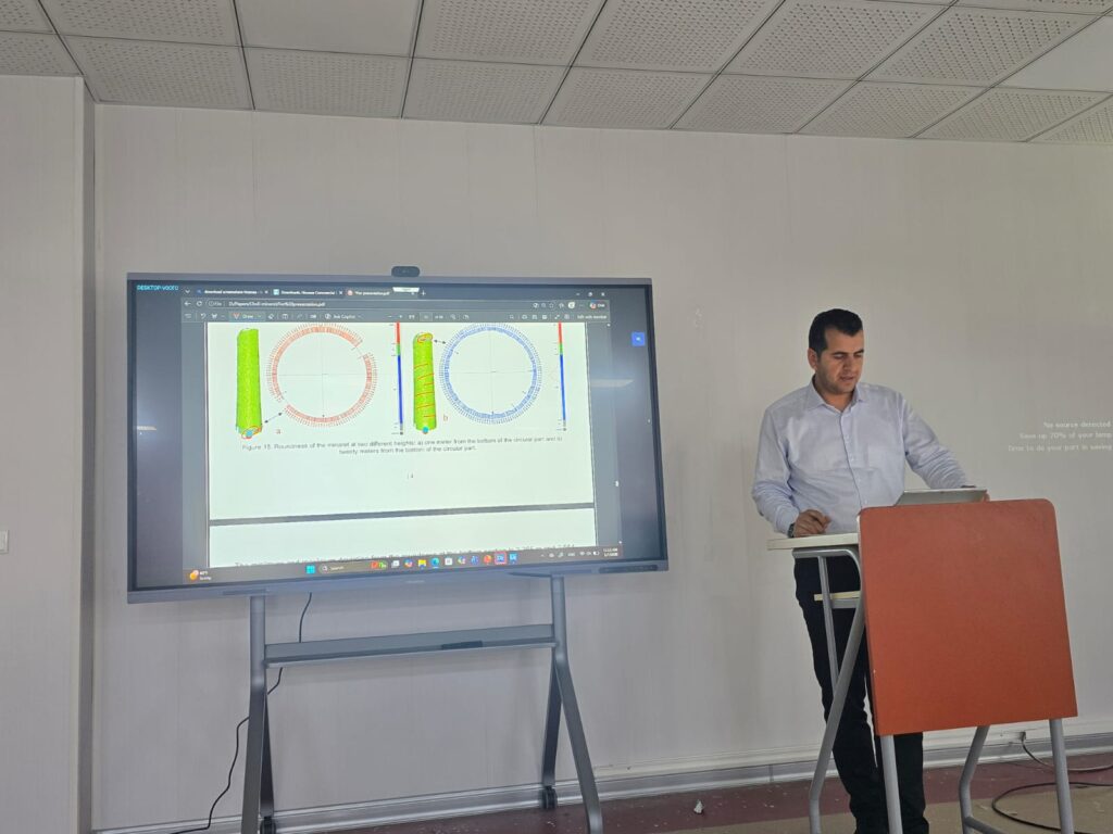
Laser scanning is an advanced surveying technique widely used for 3D modeling, monitoring, as-built surveys, and accurate data collection. In this study, the inclination and deviation of the heritage Choli Minaret were investigated using a total station and a BLK360 laser scanner. The aim was to obtain reliable geometric data and create an accurate 3D model of the minaret despite challenges caused by its height, isolated location, and hidden internal staircases. The results showed that the minaret had inclined 71 cm toward the south. The damage observed in the upper section and the concavity in the southern middle part indicate that the deviation developed gradually due to rainfall effects.